Our semi detached house was roughly built in 1973 and at the time was the end of the cul de sac. We moved into this property in 2010. The property has a retaining wall to the left as your look at it running, unfortunately, two thirds of the length of the land. This means the wall is roughly 30m. The wall starts at roughly one foot high, and ends up being approximately 4 foot tall. This retaining wall overlooks a public footpath, which runs between our house and the neighbour.
Neighbours to the right of us suggest there were once fields at the end of the cul de sac. However, they have since extended the cul de sac, probably in the early 80s, and there's now another 20 or so houses after ours. Presumably, at this time, the public footpath that runs between us and the neighbours to our left was put into place. It's impossible to say whether or not this retaining wall was built then and by whom.
We recently had a landscaper out for something else and he said that the bricks used for the wall are completely different to those used in/on the house, or any other house on the street. Whether this has any relevance, I have no idea...
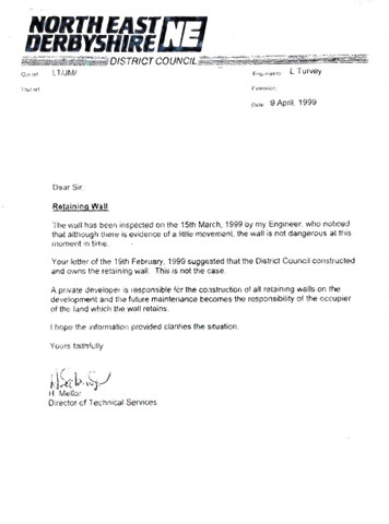
We have a copy of a letter that one of the previous owners had sent to the council back in 1999 questioning the condition and ownership of the retaining wall (attached). The council have quite simply denied all responsibility. Whilst this may be the case, I definitely want to investigate and ensure we're not just being fobbed off, as I doubt the cost of repairing/replacing this wall will be cheap.

I'm unsure if the condition of the wall has changed since 1999, I would assume it has, but at what rate/speed I don't know. All I know is that it's got a good bow on it, and some bricks are coming loose. It doesn't look the best, thats for sure.
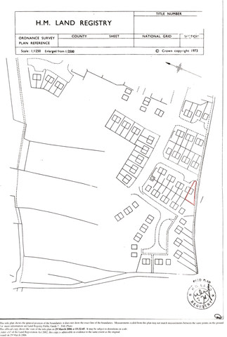
The title deeds and plans that we have (attached) are very vague, as I assume they mostly are.

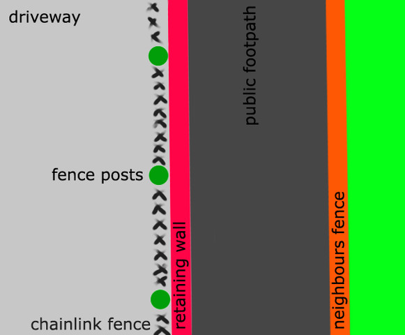
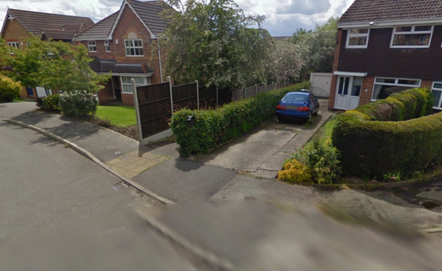
Whats bizarre is that we also have fence posts and a chainlink fence INSIDE this wall (picture drawn to try and make this clearer), on our property. Which either suggests a fence was put up later down the line and folks were lazy and just used owned land. OR, this could be the original boundary. In the Google Maps pic, the chainlink fence is covered by a hideous bush (which is no doubt causing the wall some unnecessary stress!)


If you walk down the footpath, neighbours that have a boundary with this path, having fencing or the like that seems to be consistent with the chain link fence.
How/where can I go with this?
Neighbours to the right of us suggest there were once fields at the end of the cul de sac. However, they have since extended the cul de sac, probably in the early 80s, and there's now another 20 or so houses after ours. Presumably, at this time, the public footpath that runs between us and the neighbours to our left was put into place. It's impossible to say whether or not this retaining wall was built then and by whom.
We recently had a landscaper out for something else and he said that the bricks used for the wall are completely different to those used in/on the house, or any other house on the street. Whether this has any relevance, I have no idea...
We have a copy of a letter that one of the previous owners had sent to the council back in 1999 questioning the condition and ownership of the retaining wall (attached). The council have quite simply denied all responsibility. Whilst this may be the case, I definitely want to investigate and ensure we're not just being fobbed off, as I doubt the cost of repairing/replacing this wall will be cheap.

I'm unsure if the condition of the wall has changed since 1999, I would assume it has, but at what rate/speed I don't know. All I know is that it's got a good bow on it, and some bricks are coming loose. It doesn't look the best, thats for sure.
The title deeds and plans that we have (attached) are very vague, as I assume they mostly are.

Whats bizarre is that we also have fence posts and a chainlink fence INSIDE this wall (picture drawn to try and make this clearer), on our property. Which either suggests a fence was put up later down the line and folks were lazy and just used owned land. OR, this could be the original boundary. In the Google Maps pic, the chainlink fence is covered by a hideous bush (which is no doubt causing the wall some unnecessary stress!)


If you walk down the footpath, neighbours that have a boundary with this path, having fencing or the like that seems to be consistent with the chain link fence.
How/where can I go with this?


Comment